The Gokaido: the 5 historical roads of Japan 五街道
- Published on : 01/07/2019
- by : S.V.
- Youtube
On the way on the Five roads of Edo: the 5 major roads of Gokaido.
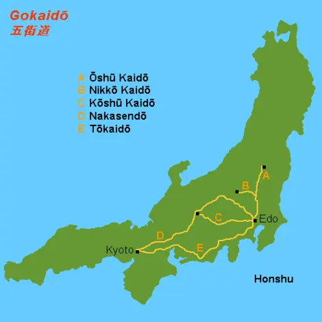
During the Edo period (1603-1868), there were five major roads in the archipelago called the Gokaido. These roads all had as their starting point the Nihonbashi bridge in Edo (former name of the city of Tokyo): the Tokaido and the Nakasendo to join Kyoto, the Koshu kaidô to reach the province of Kai, the Oshu kaido joining the province of Mutsu and the Nikko kaido to go to Nikko.
The shogunal desire to create a modern road system
It was during the Tokugawa shogunate that the Gokaido was born and developed. In 1601, two years before becoming shogun, Tokugawa Ieyasu (1543-1616) ordered the first major roadworks in the nation. This reform of the road system aims to strengthen its political power throughout the national territory.
In 1604, the Nihonbashi Bridge in Edo officially became the starting point of the country's future major land transport routes. The five routes were gradually created during the 17th and 18th centuries: the Tokaidô was completed in 1624, the Nikko Kaidô in 1636, the Oshu Kaidô in 1646, the Nakasendo in 1694, and the Koshu kaido in 1772.
Legislation and strict standards structure these roads then see the light of day. These govern the width of the tracks or even the presence or absence of trees along the route. All these axes are divided into ri, a unit of measurement equivalent to 3.927 km, from Nihonbashi. Each of the ri is indicated to travelers by two small mounds of earth topped with vegetation located face to face on either side of the road, the ichiriri tsuka.
Several hundred kilometers long, the gokaidô are dotted with relay stations or stations called shukuba in which there are inns, checkpoints, and horse relay stations. Note also that the shogunal regulations also provide for the number of horses permanently available in these relays. Cesshukuba is 7 to 10 km apart from each other depending on the route taken.
For more than 250 years, daimyos, merchants, craftsmen, samurai, pilgrims, and travelers of all kinds will thus survey these five routes on foot, on horseback, or in a rickshaw.
" Finally this morning, at five o'clock, on a splendid morning which announces a day of the fire, we get into a char-à-bancs. along the banks of the Odawara River. From there, we will continue on foot, on horseback, in kangho[…] The Tokaido is, as always, very lively. Travelers on foot, in norimon, in kangho, women, children, men with two swords, priests with shaved heads, follow each other almost without interruption. " (Walking Around the World. Volume 1 (1873) by Joseph Alexander von Hübner).
Good travel conditions
Western travelers arriving in Japan in 1858, after two centuries of isolationist policy, unanimously praise the quality of this land communication network.
The Gokaidô are wide and lined with two ditches to evacuate the water. These roads also benefit from exceptional regular maintenance, enabling them to remain in good condition all year round.
The sankin-kotai, a system of alternating residence of daimyos established in 1635 by the shogun Tokugawa Iemitsu is certainly no stranger to this state of affairs. Obliged to spend one year out of two in Edo, leaving their families there when they return to their stronghold, the daimyos accompanied by their imposing procession frequently travel these roads of the archipelago. Before their passage, the roads strewn with sand are swept, watered, and cleared of dirt of all kinds.
Many stories from the second half of the 19th century describe in detail the conditions of travel on the Gokaido and in particular on the Tokaido, the busiest roads.
“It is a very well-maintained roadway which is most picturesque. linked together by thatched cottages, isolated farms, and teahouses. The whole road thus resembles a long street. The travelers one meets there go on foot or are carried either in large litters (norimons) or narrow and awkward chairs (kangas) .” (A trip around Japan by Rodolphe Lindau, 1864)
What are the routes of the Gokaido?
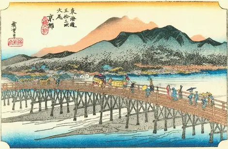
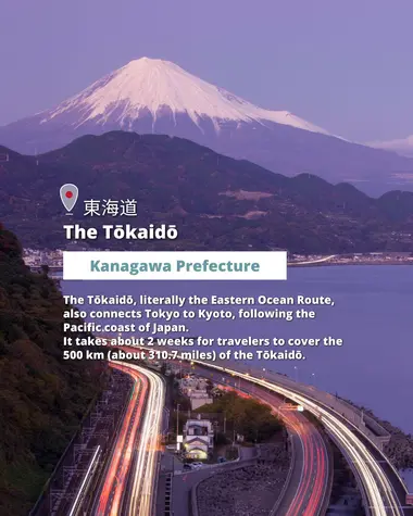
The Tokaidô, literally the way of the eastern ocean, connects the city of Edo, the seat of the shogunal government, to Kyoto, the imperial city, along the Pacific coast of Japan. This way is punctuated by 53 shukuba to which are added the starting point in Edo, the Nihonbashi bridge, and the point of arrival, the Sanjôbashi bridge in Kyoto. It takes about 2 weeks for travelers to travel the 500 km of Tokaido.
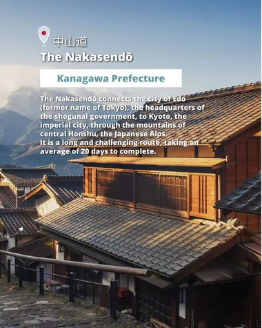
The Nakasendō or Kisokaidō also connects Edo to Kyoto but takes another route through the central mountains of Honshu, the Japanese Alps, which earned it its name "central mountain road". It is, therefore, more difficult and longer than the Tokaidô. Twenty days are needed to complete the 533 km and 69 stages of the Nakasendo.
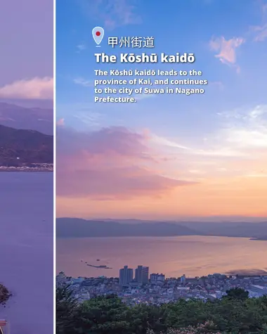
Since the Edo period (1603-1868), the Koshu kaido has made it possible to reach the province of Kai (the current prefecture of Yamanashi). It was then possible to continue to the city of Suwa in the prefecture of Nagano by taking part in the Nakasendo. Forty-four stations allowed travelers to rest on the 200 km long path.
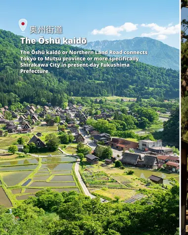
The Oshu kaido or Northern Land Route connects Edo to the province of Mutsu or more precisely the city of Shirakawa in the current prefecture of Fukushima. About 180 km long, it is punctuated by 27 stations, the first 17 of which are common with the Nikko kaido.
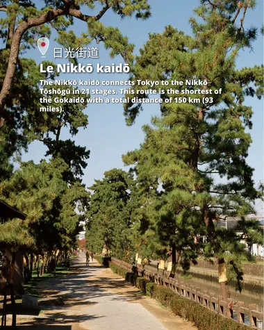
The Nikko kaido connects Edo to the Nikkô Tôshô-gû in 21 steps. This route is the shortest on Gokaido with a total distance of 150 km.
Where to find these remains of the Gokaidô?
The rapid modernization of the archipelago during the Meiji era (1868-1912) and the galloping urbanization of the 20th century got the better of Gokaido.
While some of today's major roads and railways are largely modeled on these old roads, the fact remains that the gokaidô have almost completely disappeared from the Japanese landscape.
However, some sections have been saved and remain accessible. In these few cases, local authorities and tourist associations are working hard to preserve them.
These remains attract many tourists every year who are aware of going to meet an important part of Japanese history.
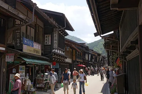
- For the Nakasendô: between Tsumago and Magome in the Kiso valley; between Nakatsugawa Juku and Magome Juku, then between Fujimura Kousatsube (3 km from Takenami station) and Hosokute juku (0.13 km from JR Mizunavi) in the Mino valley.
- For Tokaidô: between Hakone-Yumoto station, the terminus of the Odakyu line, and Hakone Sekisho, a former checkpoint. A hike on the historic Tokaido Trail is called the Hakone Kyu Kaido .
- For the Nikko kaido: it is necessary to announce a portion of 16 km on the national road 119 between Utsunomiya and Nikkô. Although it is not an ancient section, the road follows the old route of the Nikkokaido and offers one of the most beautiful places for hanami with more than 1,500 Japanese cherry trees planted along the route.


