Okutama Mukashi Michi
The Okutama Mukashi Michi (Old Okutama Road; 奥多摩むかし道) is a popular hiking trail, covering the distance between Okutama JR Station and Okutama Lake in the mountains of western Tokyo. Okutama Mukashi Michi is particularly well-known for its autumn colors.
- Starting the Hike
- Abandoned Rail Tracks
- The Former Koshu Ura Kaido
- History of the Koshu Ura Kaido Road
- Hiking the Road
- Shirahige Shrine
- Shidakura Bridge
- Dodokoro Bridge
- Access
Tokyo City Guides: Hiking the Old Okutama Road, Tokyo 奥多摩むかし道 東京
by Johannes Schonherr
The Okutama Mukashi Michi (Old Okutama Road) is a popular hiking trail, covering the distance between Okutama JR Station and Okutama Lake in the mountains of western Tokyo. On its 9km run, the trail, well inside the Chichibu-Tama-Kai National Park, follows for the most part the historic Koshu Ura Kaido (Koshu Back Road), connecting Ome, Tokyo with Kofu, Yamanashi Prefecture.
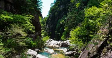
 Tama River seen from the Okutama Mukashi Michi in autumn
Okutama Station, Tokyo
It is a beautiful walk along the Tama River Valley, peppered with historic landmarks to the right and left and with gorgeous views towards the river itself. The views are most stunning during the autumn color season.
Though it is certainly a popular and well-marked trail, on weekdays not many hikers are on the road even in the most colorful times of fall. It does get crowded on weekends and holidays.
There are no shops on the way, there is hardly any soft drink vending machine. Bring your own supplies. Fresh water however is available aplenty thanks to small mountain streams running towards the Tama River.
 Map at the start of the Okutama Mukashi Michi in Hikawa, Okutama, Tokyo
Starting the Hike
Okutama Station is the final stop of the JR Ome Line, connecting to the JR Chuo Line and with that to Tokyo Station and Shinjuku Station, from either Tachikawa or Ome.
Okutama Town covers a very widely spread-out mountain area. Okutama Station is located most centrally in the former village of Hikawa.
Walk out of the station, turn left and walk down to Highway 411. At the intersection, you find the Okutama Visitor Center. There, good maps covering all the details of the Mukashi Michi are available in English. (Please note that the Visitor Center is closed on Monday).
After picking up your map, briefly walk along Highway 411 and cross the Nippara River via the Hikawa Big Bridge.
Shortly behind the bridge is a convenience store. That is the last point to stock up on supplies.
The maps generally refer to a flower shop a few steps behind the convenience store as the actual starting point of the Mukashi Michi. The building that housed the shop is still standing but the shutters are down and there is no visible indication that it used to be a flower shop.
Anyway, at the first small road turning right after the convenience store, you find a big sign spelling out that the Mukashi Michi starts right there, complete with a map of the whole route. It is all in Japanese but easy to understand even if you can’t read the language. Just try to remember the words むかし みち. That is Mukashi Michi in hiragana. All signs further down the road will use that same spelling. There are no signs in English along the trail.
Turn into that small road and then left 35 meters later. It is a rather steep footpath from there on, passing by the small Haguromita Shrine.
 Abandoned railway tracks seen from the Okutama Mukashi Michi
 Old railway tunnel close to the Okutama Mukashi Michi
Abandoned Rail Tracks
Walk on but keep your eyes to the right. Hidden behind the foliage, you will soon discover the entrance to an old railway tunnel, leading back towards Hikawa.
That is the first tunnel of about 25 on the abandoned Hikawa - Ogouchi rail line. The railway was built to transport supplies for the construction of the Ogouchi Dam, the dam that formed Okutama Lake (also known as the Ogouchi Reservoir).
Soon after the completion of the dam in 1957, the rail line fell into disuse. Its course is not marked on any current map and google satellite images are not much use when trying to follow its route either - it is totally overgrown by now.
Hiking the rail line might look like an adventurous alternative at times when the Mukashi Michi is crowded but many of its bridges have rotted away to a state where it might be close to suicidal trying to cross them. Hiking the tracks means also that you miss out on all the historical sites the old road is dotted with.
 View towards the mountains and the Tama River from the Okutama Mukashi Michi
The Former Koshu Ura Kaido
Soon after passing the railroad tunnel, the trail joins the actual historic Koshu Ura Kaido Road.
It is a paved road, still serving the inhabitants of remote settlements though vehicular traffic is very rare today.
From early Edo times on (1603-1868), the Ome Kaido was a major highway, connecting Edo (Tokyo) with Ome and its limestone quarries crucial for construction in the capital. That highway was later extended to cover all the way to Kofu in today's Yamanashi Prefecture, serving as a shortcut to the actual Koshu Highway.
After the construction of the Ogouchi Dam (1932-1957), a new highway was built, Highway 411, running the same distance in modern highway fashion.
The old road became a rural back road until someone at Okutama town hall came up with the idea to promote it as a hiking trail at some point in the 1980s.
Hiking the Road
After the rather steep start right after Hikawa, the road itself is rather even and a very easy walk. You pass through several tiny villages, you walk by small waterfalls, the Fudo No Uetaki Falls being the largest, a number of shrines line the road.
 Shirahige Shrine, Okutama Mukashi Michi
Shirahige Shrine
The shrine most noteworthy is the Shirahige Shrine. It is located right next and almost underneath a big rock wall called the Shirahige Oiwa. A nearby sign points out that the rock surface features geological fault lines many million years old.
The shrine itself is a beautiful example of a remote but serene mountain shrine. It is still in use today occasionally for various ceremonies.

Abandoned rest-house at the Okutama Mukashi Michi
No more than 3 people are allowed on the Shidakura Bridge at the same time
Shidakura Bridge
The Shidakura Bridge is a suspension bridge over the Tama River Valley. It leads to a dead end and was apparently built to provide visitors with a river view. No more than 3 people should walk the bridge at the same time, a sign points out. In fact, the bridge starts swaying noticeably even when only one person walks it.
Dodokoro Bridge
The Dodokoro Bridge is another suspension bridge leading to a dead end but offering good river views. It is more stable than the Shidakura Bridge - 5 people can enter it at the same time.
Nishikubo Tunnel
Shortly after the Dodokoro Bridge, you see the Nishikubo road tunnel on your right. Walking through the tunnel brings you quickly to Highway 411 and into the vicinity of two bus stops (one in each direction once you hit Highway 411).
Many hikers choose the Nishikubo Tunnel as their exit point from the Mukashi Michi.
 Okutama Lake seen from the Okutama Mukashi Michi
Spotting Okutama Lake from the Mukashi Michi
Shortly after walking by the tunnel, the Mukashi Michi turns into a very steep and narrow trail.
The trail leads up to the Sengen Shrine, offering very good mountain views from there, then takes a sharp turn and runs on top of what the map calls a "cliff". In fact, it is more like a very steep slope but it is surely wise to watch out where to step. From the top of the "cliff" the concrete wall of the Ogouchi Dam comes into sight for the first time.
Aome Fudosan Rest House
A few steps on, you reach the Aome Fudosan Rest House. It offers a terrace to sit down with a coffee and some food, overlooking Okutama Lake.
It would be easy to leave the Mukashi Michi here and just walk the vehicular road down to Takinorisawa bus stop on Highway 411. Many hikers choose this option.
Final Part of the Mukashi Michi
After the Aome Fudosan Rest House, the Mukashi Michi becomes a very narrow trail again. This part of the hiking trail appears to be the least walked. The trail cuts through a mountain slope high above Okutama Lake in a somewhat circular fashion, offering many lake views.
Eventually, it rather steeply declines towards a small village. The Mukashi Michi ends right in front of the Omugishiro Tunnel of Highway 411.
From there, you can enter the Ogouchi Dam area of Okutama Lake with its Mizu-to-Midori-no-Fureaikan Museum through a back staircase. The Mizu-to-Midori-no-Fureaikan is a small museum focused on the local contribution to the Tokyo water supply and the surrounding nature. On the top floor of the museum is a restaurant.
Nishi Tokyo buses back to Okutama Station leave in front of the museum.
Nishi Tokyo bus company bus departure schedule from Okutama Lake to Okutama Station. It's in Japanese but very easy to understand: The green section lists weekday departure times, the blue section Saturdays, the pink section Sundays and public holidays. The bus fare for an adult is 350 yen.
Nishi Tokyo buses accept SUICA / PASMO cards.
Access
Train
JR Chuo Line Rapid from Tokyo Station or Shinjuku to Ome, or transfer to the JR Ome Line at Tachikawa Station. Change to an Okutama bound train in Ome.
Okutama Visitor Center
More information on the Mukashi Michi is available at the Okutama Visitor Center in Hikawa, Okutama.
Opening times: Daily from 9am to 4.30pm. Closed on Monday. If Monday is a public holiday, the Visitor Center will be closed on the following Tuesday. Closed also from December 29th to January 3rd.
Address: 171-1 Hikawa, Okutama Town, Tokyo
Tel: 0428 83 2037
Website www.okutama-vc.com (in Japanese)
 Okutama Lake, Tokyo


